簽到天數: 3291 天 [LV.Master]伴壇終老
|
 t02436|2016-10-7 13:55
|
顯示全部樓層
t02436|2016-10-7 13:55
|
顯示全部樓層
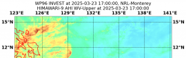
03Z評C4下限的115節,大圓圈路徑發生中,五天後將繞回到原點。
000
WTNT44 KNHC 070257
TCDAT4
HURRICANE MATTHEW DISCUSSION NUMBER 36
NWS NATIONAL HURRICANE CENTER MIAMI FL AL142016
1100 PM EDT THU OCT 06 2016
The satellite appearance of Matthew has improved during the past
several hours, with an eye embedded within a more circular central
dense overcast and an increase in the outer banding. Reports from
a NOAA Hurricane Hunter aircraft and coastal radar data show the
presence of centric eyewalls with diameters of about 8 and 60 n mi
respectively. The NOAA aircraft earlier reported a minimum pressure
of 937 mb, and an Air Force Reserve Hurricane Hunter just reported
estimated surface winds of 109 kt from the SFMR and a pressure of
939 mb. Based on these data, the initial intensity is 115 kt.
The initial motion is 325/11 kt. For the next 24-48 hours, Matthew
should move around the western end of the subtropical ridge, with
the motion gradually turning northward and then northeastward.
During this time, the center of the guidance envelope and the
various consensus models have shifted a little to the east. However,
the ECMWF, GFS, and UKMET continue to suggest the possibility of the
hurricane making landfall in Florida and then moving near the coasts
of Georgia and South Carolina. This part of the forecast is nudged
a little to the east and lies between the model consensus and the
previous forecast. After 48 hours, a mid- to upper-level ridge is
forecast to build north and west of Matthew, and the track guidance
forecasts a southeasterly to southerly motion in response. While
there is still a large spread, the GFS, ECMWF, and UKMET are in
better agreement that Matthew should move south between the ridge
and Hurricane Nicole to the east. This part of the forecast follows
this guidance and lies between the GFS and ECMWF.
During the next 12-24 hours, Matthew will likely weaken a little as
it undergoes an eyewall replacement cycle. After that time, it is
expected to encounter strong southwesterly vertical shear, and later
in the forecast period dry air is likely to entrain into the
cyclone. This combination should cause steady weakening, and
Matthew is forecast to drop below hurricane strength by 72 hours.
The new intensity forecast is in best agreement with the SHIPS
model.
KEY MESSAGES:
1. Matthew is likely to produce devastating impacts from storm
surge, extreme winds, and heavy rains in the northwestern Bahamas
today, and along extensive portions of the east coast of Florida
tonight.
2. Evacuations are not just a coastal event. Strong winds will
occur well inland from the coast, and residents of mobile
homes under evacuation orders are urged to heed those orders.
3. Hurricane winds increase very rapidly with height, and residents
of high-rise buildings are at particular risk of strong winds. Winds
at the top of a 30-story building will average one Saffir-Simpson
category higher than the winds near the surface.
4. When a hurricane is forecast to take a track roughly parallel to
a coastline, as Matthew is forecast to do from Florida through South
Carolina, it becomes very difficult to specify impacts at any one
location. Only a small deviation of the track to the left of the
NHC forecast could bring the core of a major hurricane onshore
within the hurricane warning area in Florida and Georgia. Modest
deviations to the right could keep much of the hurricane-force winds
offshore. Similarly large variations in impacts are possible in the
hurricane watch and warning areas in northeast Georgia and South
Carolina.
5. The National Hurricane Center is issuing Potential Storm Surge
Flooding Maps, and Prototype Storm Surge Watch/Warning Graphics for
Matthew. It is important to remember that the Potential Storm Surge
Flooding Map does not represent a forecast of expected inundation,
but rather depicts a reasonable worst-case scenario -- the amount of
inundation that has a 10 percent chance of being exceeded.
FORECAST POSITIONS AND MAX WINDS
INIT 07/0300Z 27.1N 79.2W 115 KT 130 MPH
12H 07/1200Z 28.5N 80.2W 110 KT 125 MPH
24H 08/0000Z 30.3N 80.8W 105 KT 120 MPH
36H 08/1200Z 31.8N 80.2W 90 KT 105 MPH
48H 09/0000Z 32.6N 78.7W 75 KT 85 MPH
72H 10/0000Z 31.5N 75.5W 60 KT 70 MPH
96H 11/0000Z 29.0N 75.5W 50 KT 60 MPH
120H 12/0000Z 27.0N 77.0W 40 KT 45 MPH
$$
Forecaster Beven


將一路沿佛羅里達州北上,經過喬治亞到南卡羅來納州外海才轉向。

|
|