|
|
NHC 強度升四級颶風,預計已經到達顛峰,24H後到達中太。
058
WTPZ45 KNHC 050239
TCDEP5
Hurricane Hector Discussion Number 18
NWS National Hurricane Center Miami FL EP102018
800 PM PDT Sat Aug 04 2018
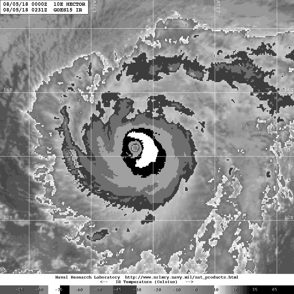
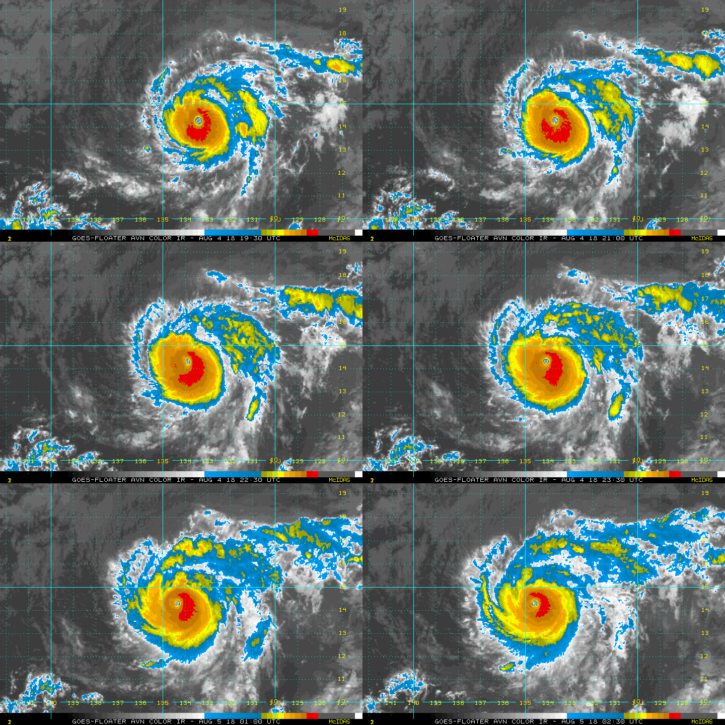
Hector has the textbook appearance of a major hurricane in satellite
imagery this evening, as it is maintaining a well-defined 10 nm
wide eye inside a central dense overcast. Satellite intensity
estimates are mostly near 115 kt, and based on these estimates that
will be the initial intensity for this advisory. The most notable
change since the last advisory has been an increase in convection
in an outer band that now mostly surrounds the CDO.
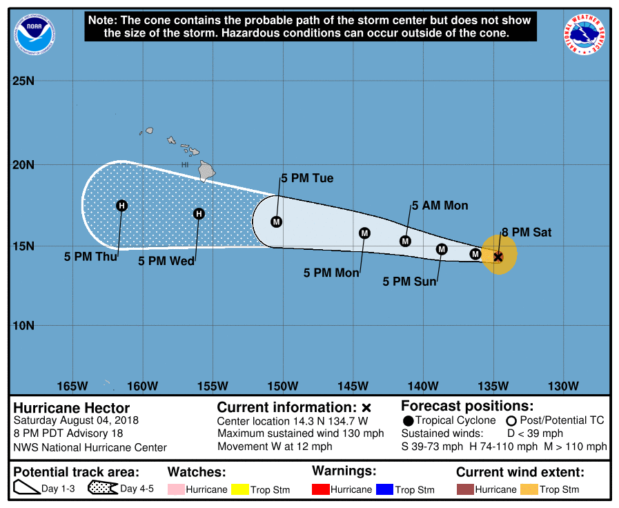
The initial motion is 275/10. There is little change to the
forecast philosophy from the previous advisory. A large subtropical
ridge to the north should steer the hurricane generally westward
through the forecast period, with Hector gradually gaining some
latitude on Sunday and beyond due to a weakness in the ridge. By
72-96 h, most of the guidance shows a more westward motion south of
the Hawaiian Islands. Based on slight shifts in the consensus
models, the new forecast track is nudged a little to the north of
the previous track through 72 h, and it is similar to the previous
track after that time. It should be noted that there remains some
spread in the dynamical models as Hector approaches Hawaii, with
the NAVGEM, HWRF, and GFS to the north of the center of the
guidance envelope and the ECMWF to the south.
The recent increase in outer band convection decreases the short-
term chance that Hector will become an annular hurricane. However,
the cyclone will be in the light-shear moderate-SST conditions
favorable for such an evolution, and it could occur later in the
forecast period. Before this, it is likely that Hector will
undergo another eyewall replacement with associated fluctuations in
intensity. After 36-48 h, the hurricane should start to encounter
a drier airmass and slowly weaken in consequence. The new NHC
intensity forecast is unchanged from the previous one, and it lies
at the upper end of the intensity guidance.
While the official forecast track continues to lie south of the
Hawaiian Islands, it is too soon to determine what kind of impacts
might occur in the state, since track errors can be large at long
time ranges. This remains a good time for everyone in the Hawaiian
Islands to ensure they have their hurricane plan in place. For
additional information on any potential local impacts from Hector in
Hawaii, please refer to products issued by the NWS Weather Forecast
Office in Honolulu at http://www.prh.noaa.gov/hnl .
FORECAST POSITIONS AND MAX WINDS
INIT 05/0300Z 14.3N 134.7W 115 KT 130 MPH
12H 05/1200Z 14.5N 136.3W 115 KT 130 MPH
24H 06/0000Z 14.8N 138.7W 115 KT 130 MPH
36H 06/1200Z 15.3N 141.3W 115 KT 130 MPH
48H 07/0000Z 15.8N 144.2W 110 KT 125 MPH
72H 08/0000Z 16.5N 150.5W 100 KT 115 MPH
96H 09/0000Z 17.0N 156.0W 90 KT 105 MPH
120H 10/0000Z 17.5N 161.5W 85 KT 100 MPH
$$
Forecaster Beven 


|
|