簽到天數: 3291 天 [LV.Master]伴壇終老
|
 t02436|2017-9-19 17:33
|
顯示全部樓層
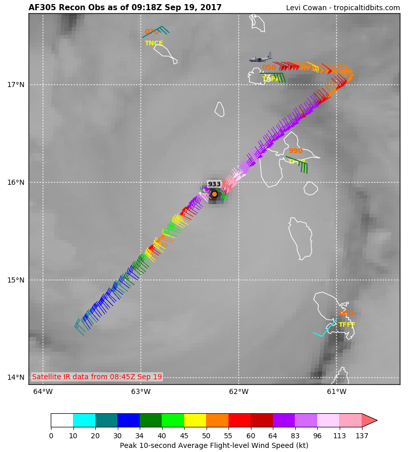
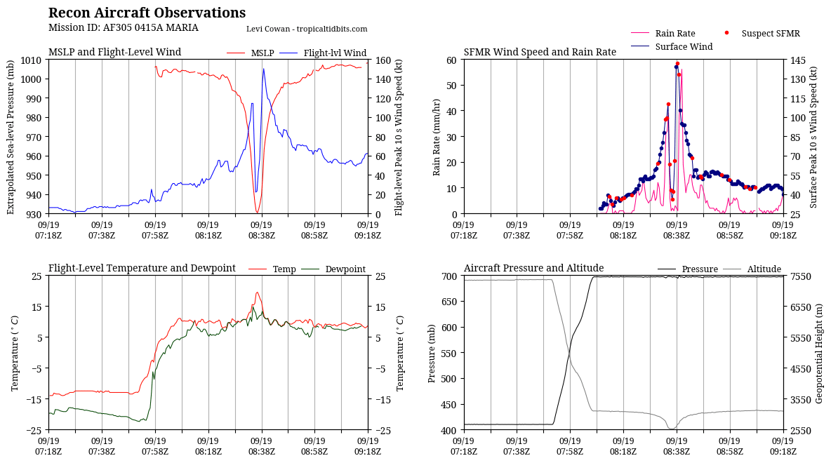
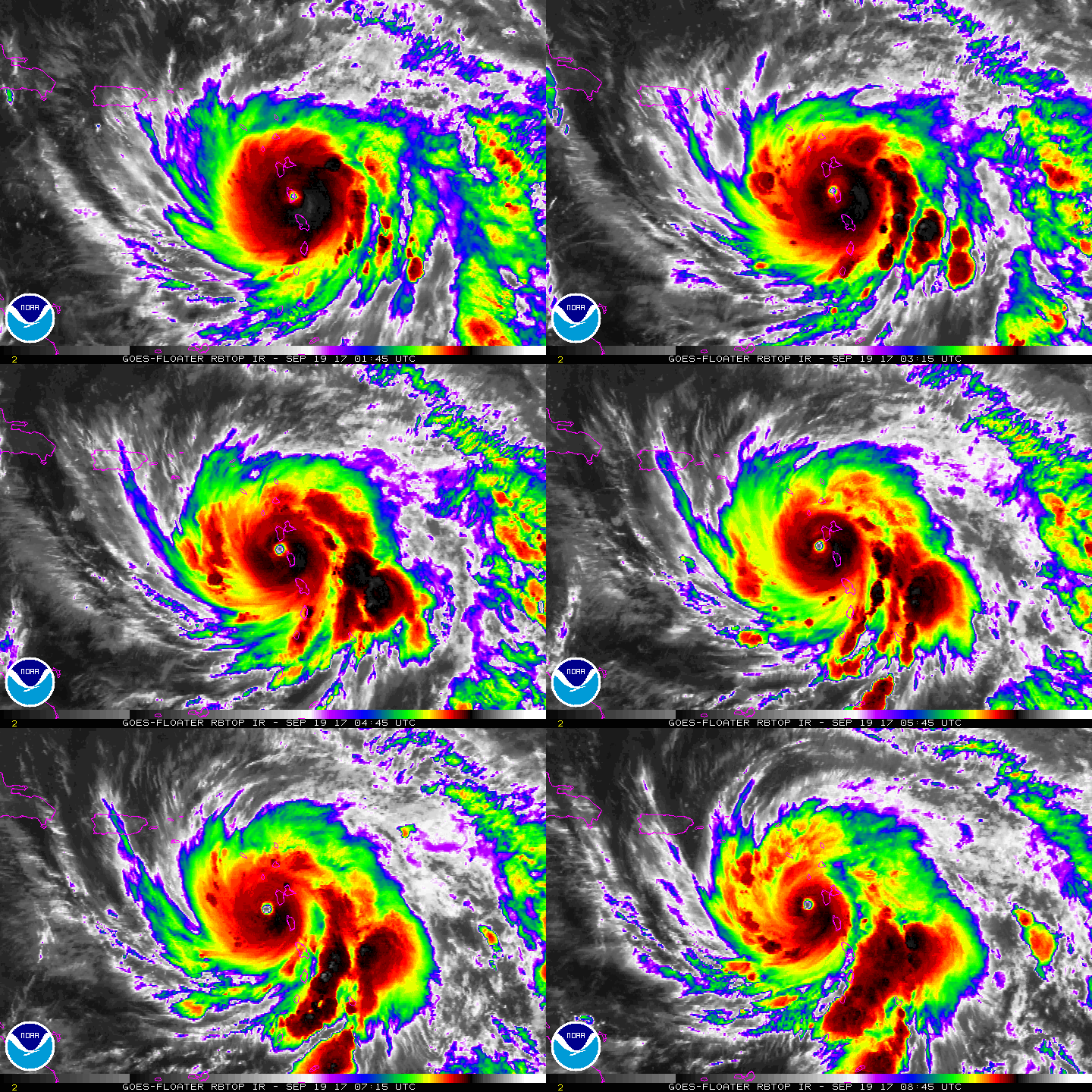
09Z正報評價135節,但在新一輪飛機實測第一次穿心之後,0910Z馬上加發更新報,直接調回140節。
000
WTNT45 KNHC 190853
TCDAT5
Hurricane Maria Discussion Number 13
NWS National Hurricane Center Miami FL AL152017
500 AM AST Tue Sep 19 2017
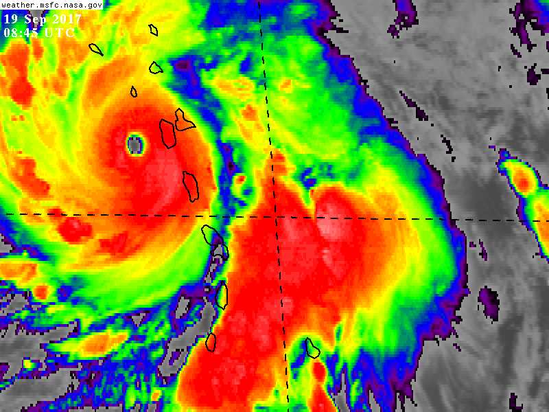
Interaction of the small core of Maria with the mountainous terrain
of Dominica caused only a slight diminution of the intensity of
the hurricane. Data from the Air Force Hurricane Hunter aircraft
after the center passed the island indicate an intensity of about
135 kt, at the high end of category 4 strength. Another Air Force
aircraft has begun investigating Maria, and preliminary data
from the plane suggest that the hurricane may have regained
category 5 intensity. Maria will be moving through a low-shear
atmospheric environment and mainly over warm waters for the next
couple of days. Some fluctuations in intensity are possible in the
early part of the forecast period due to eyewall replacement events.
Land influences could cause some weakening within the next 36
hours. Later in the forecast period, a modest increase in vertical
shear could cause some weakening. The official intensity forecast
is near or above the latest model consensus.
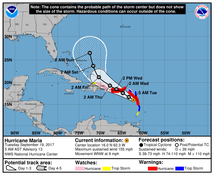
After smoothing out the trochoidal wobbles of Maria's eye, the
initial motion estimate remains west-northwestward, or 300/8 kt.
There is little change to the track forecast reasoning from the
previous advisory package. A weak ridge situated over the western
Atlantic is expected to steer Maria west-northwestward through 48
hours, and on this track the center of the hurricane is forecast to
pass near or over the Virgin Islands and Puerto Rico on Wednesday.
After that time, the western portion of the ridge is forecast to
weaken, partially due to the influence of the large circulation of
Hurricane Jose. This should cause Maria to turn northwestward, then
north-northwestward by day 4-5. There is fairly good agreement
amongst the reliable guidance, and the new official track forecast
is very similar to the previous one. This is generally near the
left side of the envelope of model tracks, and favors the ECMWF and
the corrected consensus predictions.
KEY MESSAGES:
1. Maria will affect portions of the northern Leeward Islands as an
extremely dangerous major hurricane during the next day or so.
2. Maria is likely to affect Puerto Rico and the U.S. and British
Virgin Islands as an extremely dangerous major hurricane tonight
and Wednesday. Preparations to protect life and property should be
rushed to completion.
3. A life-threatening storm surge, accompanied by large and
destructive waves, is expected for the Leeward Islands, the U.S. and
British Virgin Islands, and Puerto Rico.
4. Life-threatening flash floods and mudslides from heavy rainfall
are expected across the Leeward Islands, including Puerto Rico and
the U.S. and British Virgin Islands.
FORECAST POSITIONS AND MAX WINDS
INIT 19/0900Z 16.0N 62.3W 135 KT 155 MPH
12H 19/1800Z 16.7N 63.4W 140 KT 160 MPH
24H 20/0600Z 17.6N 64.8W 135 KT 155 MPH
36H 20/1800Z 18.5N 66.3W 125 KT 145 MPH...NEAR PUERTO RICO
48H 21/0600Z 19.3N 67.8W 125 KT 145 MPH
72H 22/0600Z 21.2N 70.4W 120 KT 140 MPH
96H 23/0600Z 23.7N 71.7W 110 KT 125 MPH
120H 24/0600Z 26.5N 72.5W 100 KT 115 MPH
$$
Forecaster Pasch
ZCZC MIATCUAT5 ALL
TTAA00 KNHC DDHHMM
Hurricane Maria Tropical Cyclone Update
NWS National Hurricane Center Miami FL AL152017
510 AM AST Tue Sep 19 2017
...MARIA REGAINS CATEGORY 5 STRENGTH...
Recent reports from an Air Force Reserve Hurricane Hunter
aircraft indicate that Maria has reintensified to category 5
status, with estimated maximum sustained winds of 160 mph (260
km/h).
SUMMARY OF 510 AM AST...0910 UTC...INFORMATION
---------------------------------------------------
LOCATION...16.0N 62.3W
ABOUT 65 MI...100 KM WSW OF GUADELOUPE
ABOUT 205 MI...325 KM SE OF ST. CROIX
MAXIMUM SUSTAINED WINDS...160 MPH...260 KM/H
PRESENT MOVEMENT...WNW OR 300 DEGREES AT 9 MPH...15 KM/H
MINIMUM CENTRAL PRESSURE...930 MB...27.46 INCHES
$$
Forecaster Pasch
NNNN
|
|