簽到天數: 1650 天 [LV.Master]伴壇終老
|
 老農民版夜神月|2021-8-24 05:18
|
顯示全部樓層
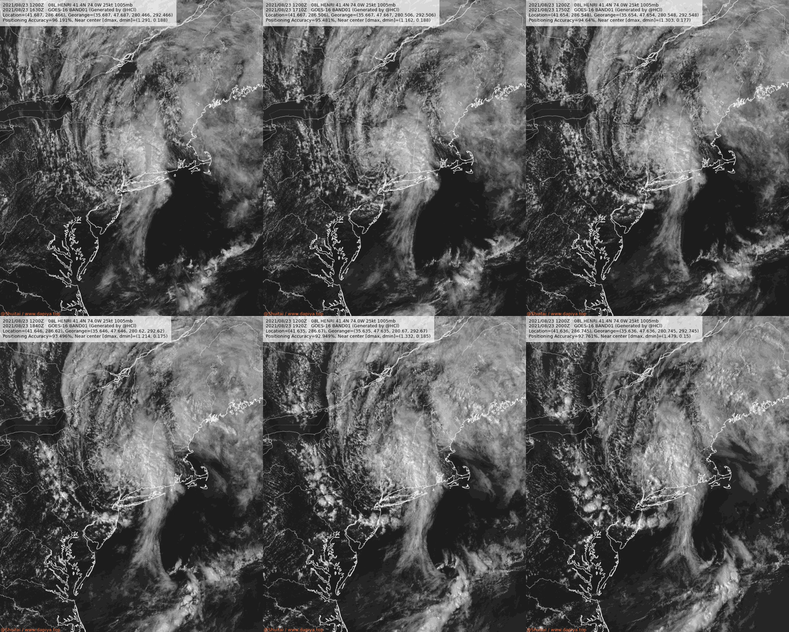
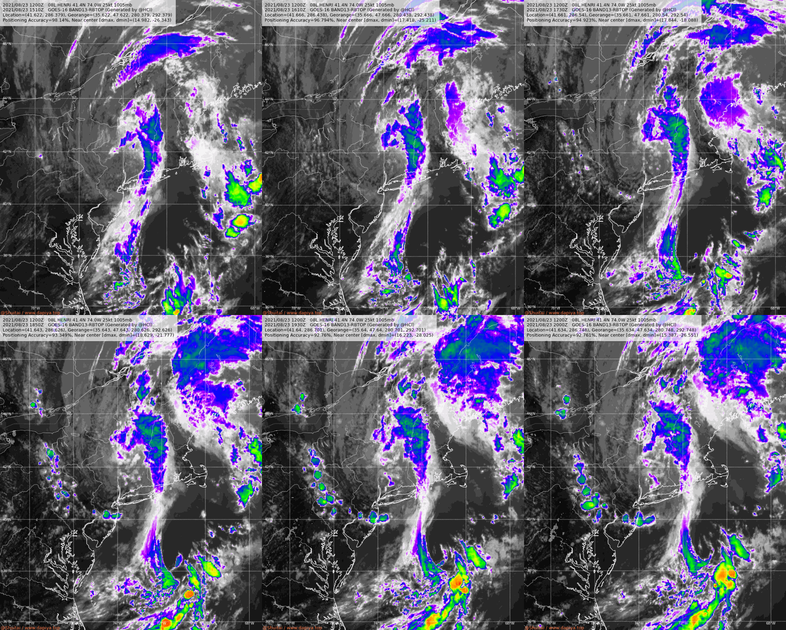
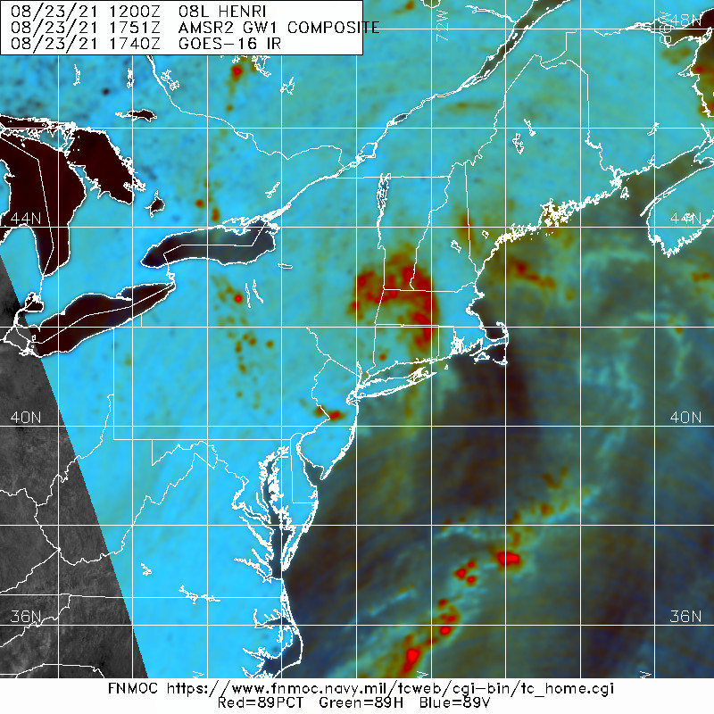
已成為後熱帶氣旋,由於仍症影響美國陸地,WPC持續對其發報000
WTNT33 KWNH 232052
TCPAT3
BULLETIN
Post-Tropical Cyclone Henri Advisory Number 32
NWS Weather Prediction Center College Park MD AL082021
500 PM EDT Mon Aug 23 2021
...HENRI IS NOW A POST-TROPICAL CYCLONE AND SLOWLY MOVING EAST...
...HEAVY RAINFALL AND FLOODING EXPECTED TO CONTINUE ACROSS PORTIONS
OF SOUTHERN NEW ENGLAND THROUGH TONIGHT...
SUMMARY OF 500 PM EDT...2100 UTC...INFORMATION
----------------------------------------------
LOCATION...41.6N 73.6W
ABOUT 60 MI...95 KM NNE OF NEW YORK CITY
ABOUT 50 MI...80 KM WSW OF HARTFORD CONNECTICUT
MAXIMUM SUSTAINED WINDS...25 MPH...35 KM/H
PRESENT MOVEMENT...ENE OR 75 DEGREES AT 9 MPH...15 KM/H
MINIMUM CENTRAL PRESSURE...1005 MB...29.68 INCHES
WATCHES AND WARNINGS
--------------------
Flood watches are in effect across portions of southeast New York
and southern New England.
DISCUSSION AND OUTLOOK
----------------------
At 500 PM EDT (2100 UTC), the center of Post-Tropical Cyclone Henri
was located near latitude 41.6 North, longitude 73.6 West. The
post-tropical cyclone is moving toward the east-northeast near 9 mph
(15 km/h) and this motion is expected to accelerate later tonight.
Maximum sustained winds are near 25 mph (35 km/h) with higher gusts.
Little change in strength is forecast during the next 24 hours.
The estimated minimum central pressure is 1005 mb (29.68 inches).
HAZARDS AFFECTING LAND
----------------------
RAINFALL: Remnant moisture from Henri is expected to produce
additional rainfall of 1 to locally 2 inches in New Jersey, eastern
Pennsylvania, and southern New York through this evening and 1 to 3
inches, with locally higher amounts possible, over southern to
central New England through tonight. Heavy rainfall from Henri will
continue to result in limited flash, urban, and small stream
flooding impacts, along with isolated minor to moderate river
flooding.
The flood risk associated with Henri is expected to diminish by
early Tuesday.
For the latest rainfall reports and wind gusts associated with Henri
at the following link:
https://www.wpc.ncep.noaa.gov/discussions/nfdscc3.html
TORNADOES: A brief tornado or two is possible across Southern
New England through this evening.
SURF: Swells are expected to continue across much of the east
coast of the U.S. and Atlantic Canada through tonight. These swells
could cause life-threatening surf and rip current conditions.
Please consult products from your local weather office.
NEXT ADVISORY
-------------
Next complete advisory at 1100 PM EDT.
$$
Forecaster Churchill/Pagano
FORECAST POSITIONS AND MAX WINDS
INIT 23/2100Z 41.6N 73.6W 20 KT 25 MPH...POST-TROP/INLAND
12H 24/0600Z 41.7N 71.9W 20 KT 25 MPH...POST-TROP/INLAND
24H 24/1800Z 42.4N 68.2W 25 KT 30 MPH...POST-TROPICAL
36H 25/0600Z...DISSIPATED 


|
|