|
|
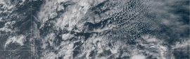
國家颶風中心在9日3時發出最後一報
000
WTNT35 KNHC 090242
TCPAT5
BULLETIN
Post-Tropical Cyclone Dorian Advisory Number 64
NWS National Hurricane Center Miami FL AL052019
1100 PM AST Sun Sep 08 2019
...POST-TROPICAL DORIAN MOVES OVER THE COLD WATERS OF THE
LABRADOR SEA AND BECOMES FULLY EXTRATROPICAL...
...THIS IS THE LAST ADVISORY...
SUMMARY OF 1100 PM AST...0300 UTC...INFORMATION
-----------------------------------------------
LOCATION...52.1N 53.4W
ABOUT 375 MI...600 KM N OF CAPE RACE NEWFOUNDLAND
MAXIMUM SUSTAINED WINDS...60 MPH...95 KM/H
PRESENT MOVEMENT...ENE OR 60 DEGREES AT 24 MPH...39 KM/H
MINIMUM CENTRAL PRESSURE...980 MB...28.94 INCHES
WATCHES AND WARNINGS
--------------------
CHANGES WITH THIS ADVISORY:
The Canadian Hurricane Center has discontinued all tropical cyclone
warnings for Atlantic Canada.
SUMMARY OF WATCHES AND WARNINGS IN EFFECT:
There are no coastal watches or warnings in effect.
DISCUSSION AND OUTLOOK
----------------------
At 1100 PM AST (0300 UTC), the center of Post-Tropical Cyclone
Dorian was located near latitude 52.1 North, longitude 53.4 West.
The post-tropical cyclone is moving toward the east-northeast near
24 mph (39 km/h) and this motion is forecast to continue through
Tuesday. On the forecast track, the center of the post-tropical
cyclone Dorian will continue to move away from Atlantic Canada
through Tuesday.
Maximum sustained winds are near 60 mph (95 km/h) with higher gusts.
Some weakening is forecast during the next 48 hours, and the
post-tropical cyclone is forecast to be absorbed by a larger low
pressure system on Tuesday.
Tropical-storm-force winds extend outward up to 415 miles (665 km)
from the center.
The estimated minimum central pressure is 980 mb (28.94 inches).
HAZARDS AFFECTING LAND
----------------------
WIND: Tropical-storm-force wind gusts will continue across portions
of southeastern Newfoundland until early Monday and then diminish by
late Monday morning.
STORM SURGE: Storm surge along the northeastern Gulf of St. Lawrence
and the West Coast of Newfoundland will continue to subside through
Monday morning.
RAINFALL: Dorian is expected to produce rainfall accumulations of
less than 1 inch across far eastern Quebec into Newfoundland and
Labrador.
SURF: Large swells are affecting the coast of Atlantic Canada, and
they will continue to affect that area during the next couple of
days. Swells along the mid-Atlantic and New England coasts of the
U.S. will continue for another day or so. These swells are likely
to cause life-threatening surf and rip current conditions. Please
consult products from your local weather office.
NEXT ADVISORY
-------------
This is the last public advisory issued by the National Hurricane
Center on this system. Additional information on this system can be
found in High Seas Forecasts issued by the National Weather Service,
under AWIPS header NFDHSFAT1, WMO header FZNT01 KWBC, and online at
ocean.weather.gov/shtml/NFDHSFAT1.php.
$$
Forecaster Stewart
上為國家颶風中心報文原文,下為機器翻譯(機器翻譯僅供參考,實際以原文為主)
000
WTNT35 KNHC 090242
TCPAT5
公告
後熱帶氣旋Dorian諮詢編號64
NWS國家颶風中心邁阿密佛羅里達州AL052019
1100 PM AST Sun Sep 08 2019
...熱帶
多利亞人在拉斯維加斯海域的冷水中移動並成為完全超級的。
...這是最後的諮詢...
摘要1100 PM AST ... 0300 ... UTC信息
------------------------ -----------------------
位置... 52.1N 53.4W
關於375 MI ... 600 KM N CAPE RACE NEWFOUNDLAND
最大持續風... 60英里/小時... 95公里/小時
現在運動... ENE或60度24馬力... 39公里/小時
最低中壓... 980 MB ... 28.94英寸
手錶和警告
--------------------本消息的
變化:
加拿大颶風中心已停止
加拿大大西洋沿岸的所有熱帶氣旋警告。
手錶和警告的概要:
沒有沿海手錶或警告有效。
討論和展望
----------------------
在AST下午11點(0300 UTC),後熱帶氣旋
多里安中心位於北緯52.1度,經度53.4西。
後熱帶氣旋正以
24英里/小時(39公里/小時)的速度向東北東北方向移動,預計這一運動將持續到
週二。在預測軌道上,後熱帶的中心
颶風多利安將
在周二繼續遠離加拿大大西洋。
最大持續風速接近60英里/小時(95公里/小時),陣風較高。
預計在接下來的48小時內將出現一些減弱,預計
週二
熱帶氣旋將被更大的低壓系統吸收。
熱帶風暴強風
從中心向外延伸至415英里(665公里)。
估計的最小中心壓力為980 mb(28.94英寸)。
影響土地的危險
----------------------
風:熱帶風暴強風陣風將持續穿越
紐芬蘭東南部的部分地區,直至週一早些時候,然後
在周一晚些時候減少早上。
風暴潮:沿著聖勞倫斯灣東北部
和紐芬蘭西海岸的風暴潮將在
周一早上繼續消退。
降雨:多利安預計將
在魁北克省東部地區向紐芬蘭和
拉布拉多產生不到1英寸的降雨量。
SURF:大浪湧正在影響加拿大大西洋沿岸,並且
在接下來的
幾天內它們將繼續影響該地區。沿美國大西洋中部和新英格蘭海岸的海浪
將持續一天左右。這些膨脹可能
會導致危及生命的衝浪和裂口潮流。請
諮詢當地氣象辦公室的產品。
下一個顧問
-------------
這是國家颶風
中心就該系統發布的最後一次公開諮詢。有關該系統的更多信息,請
參見國家氣象局發布的公海預報,
AWIPS標題為NFDHSFAT1,WMO標題為FZNT01 KWBC,在線為
ocean.weather.gov/shtml/NFDHSFAT1.php。
$$
Forecaster斯圖爾特
|
|

 照妖鏡
照妖鏡![91W JMA:TD[W] 熱帶低壓將通過台灣南部 留意大雨](data/attachment/block/f3/f36d9610a5027136e96e316fbd5a3bd4.jpg)