簽到天數: 3294 天 [LV.Master]伴壇終老
|
 t02436|2019-8-31 13:46
|
顯示全部樓層
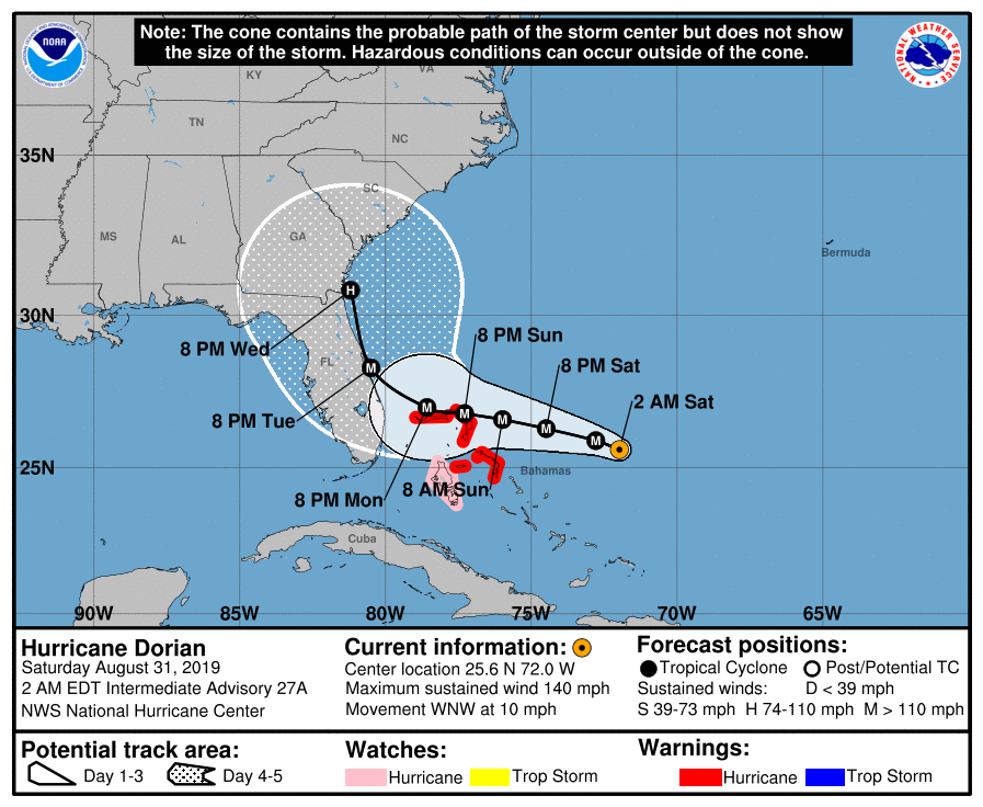
03Z報評價120節,站上C4,預報已更動為不登陸佛州,將近岸北上。
000
WTNT45 KNHC 310240
TCDAT5
Hurricane Dorian Discussion Number 27
NWS National Hurricane Center Miami FL AL052019
1100 PM EDT Fri Aug 30 2019
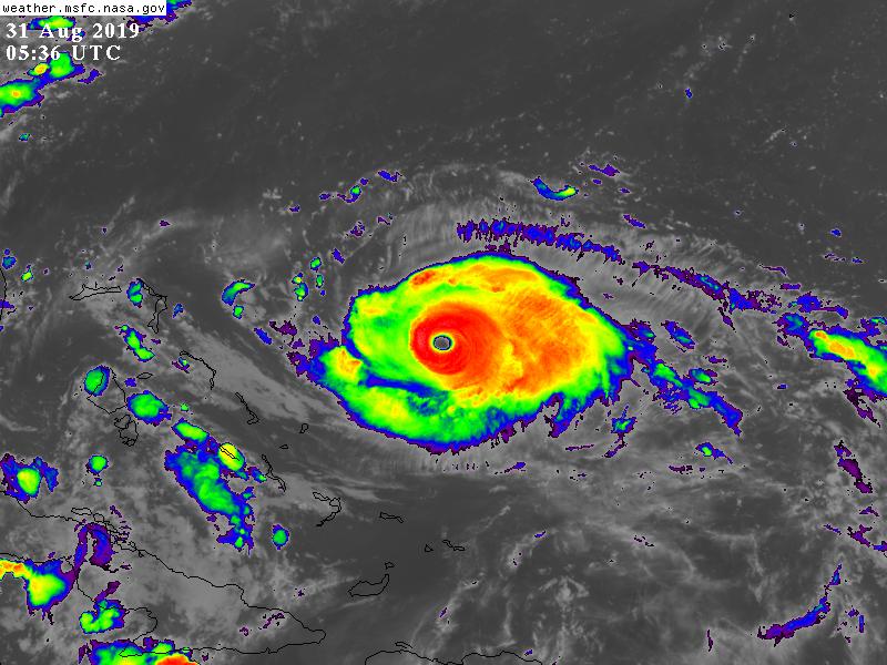
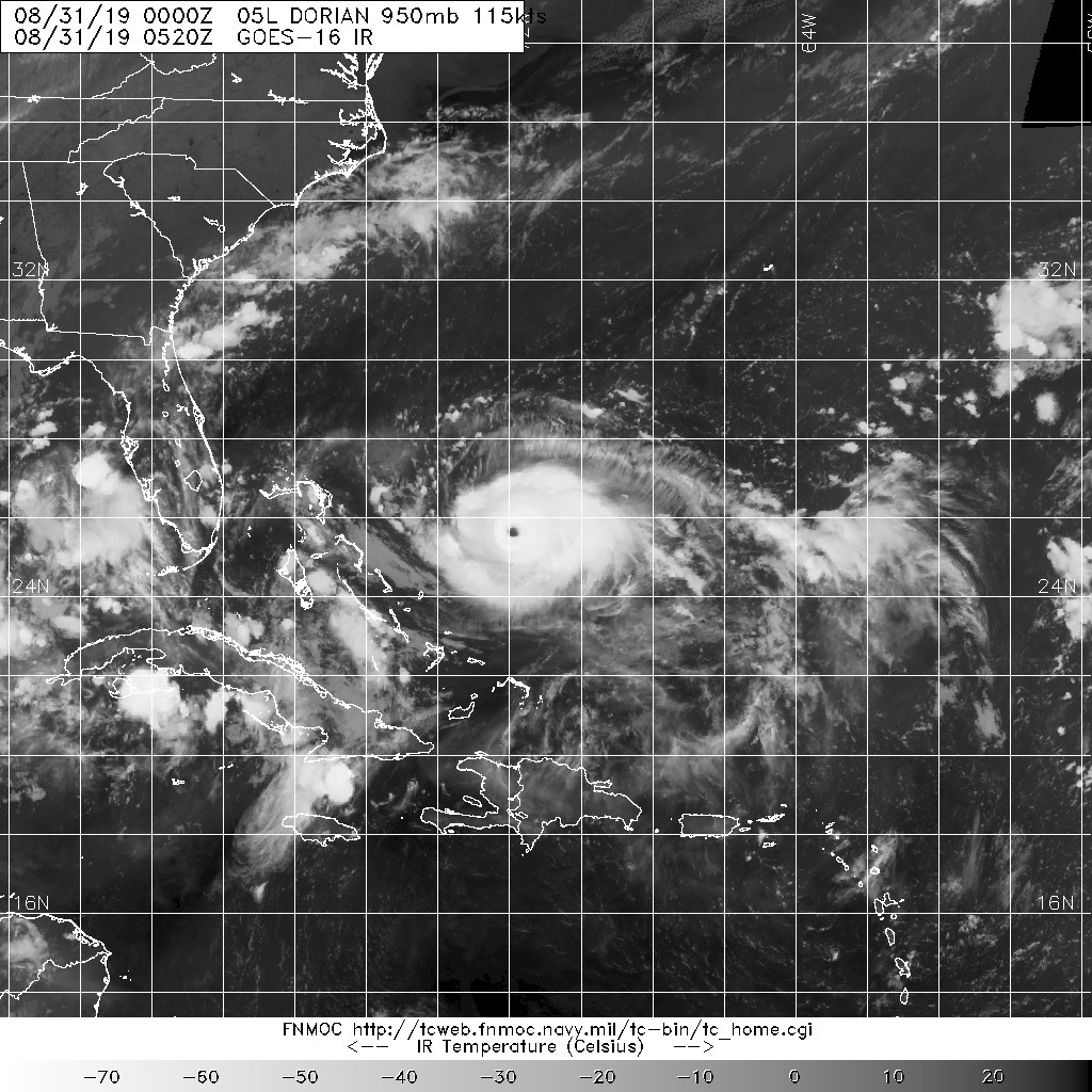
The cloud pattern of Dorian has become quite impressive in infrared
satellite imagery this evening. The eye has become very distinct
and is surrounded by a very symmetric ring of deep convection. The
upper-level outflow has also improved. A NOAA Hurricane Hunter
aircraft this evening has measured peak SFMR winds of 119 kt, and a
dropsonde dropped in the northeastern eyewall had mean winds in the
lowest 150 m that also supported winds of 118 kt, so the initial
wind speed has been raised to 120 kt. The latest center drop
indicates a minimum pressure of around 948 mb, down 22 mb since this
afternoon. Since Dorian will be traversing SSTs of around 29C and
remain in a low shear environment, the current intensification phase
may not be over. The NHC forecast is above the guidance and calls
for some additional strengthening in the short-term. After that,
fluctuations in intensity are likely due to eyewall replacement
cycles that are difficult to predict. Although some decrease in
wind speed could occur when Dorian slows down and causes some
upwelling, all indications are that Dorian will remain an extremely
powerful hurricane for the next several days.
The hurricane is moving west-northwestward or 300 degrees at
9 kt. The ridge to the north of Dorian is expected to build during
the next 24 hours, and this should cause Dorian's heading to bend
westward toward the northwestern Bahamas. After 48 hours, the
global models show an erosion of the western portion of the ridge,
which is expected to cause the steering currents to collapse and the
hurricane to slow down considerably by day 3. Later in the period,
the models have again trended to a more significant weakness in the
ridge which allows Dorian to turn northwestward, then northward
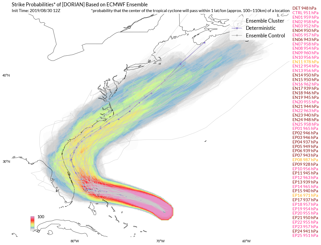
near the east coast of Florida. Although the deterministic
versions of the global models have trended northeastward again, the
GFS and UKMET ensemble means are farther to the left. The
updated NHC track forecast has been nudged northeastward and lies
between the multi-model consensus aids and the aforementioned
ensemble means. Although the official forecast track has been
nudged northeastward to near the east coast of Florida the risk of
significant impacts over much of the Florida peninsula remains high.
Key Messages:
1. A prolonged period of life-threatening storm surge and
devastating hurricane-force winds are likely in portions of the
northwestern Bahamas, where a hurricane warning is in effect.
Residents should execute their hurricane plan and listen to advice
given by local emergency officials.
2. Life-threatening storm surge and devastating hurricane-force
winds are possible along portions of the Florida east coast by early
next week, but since Dorian is forecast to slow down and turn
northward near the coast, it is too soon to determine when or where
the highest surge and winds will occur. Residents should have their
hurricane plan in place, know if they are in a hurricane evacuation
zone, and listen to advice given by local emergency officials.
3. A prolonged period of storm surge, high winds, and rainfall is
possible in portions of Florida into next week, including the
possibility of hurricane-force winds over inland portions of the
Florida peninsula.
4. Heavy rains, capable of life-threatening flash floods, are
expected over portions of the Bahamas and coastal sections of the
southeastern United States this weekend through much of next week.
FORECAST POSITIONS AND MAX WINDS
INIT 31/0300Z 25.5N 71.4W 120 KT 140 MPH
12H 31/1200Z 25.9N 72.8W 130 KT 150 MPH
24H 01/0000Z 26.3N 74.5W 130 KT 150 MPH
36H 01/1200Z 26.6N 76.0W 125 KT 145 MPH
48H 02/0000Z 26.8N 77.3W 125 KT 145 MPH
72H 03/0000Z 27.0N 78.6W 115 KT 130 MPH
96H 04/0000Z 28.3N 80.5W 110 KT 125 MPH
120H 05/0000Z 30.8N 81.2W 90 KT 105 MPH
$$
Forecaster Brown


|
|